Sunday, October 14, 2012

Bourke to Home

October 9:
Left Bourke just after 9am heading towards Brewarrina were we stopped for morning tea near the old lift bridge that crossed the Barwon River.
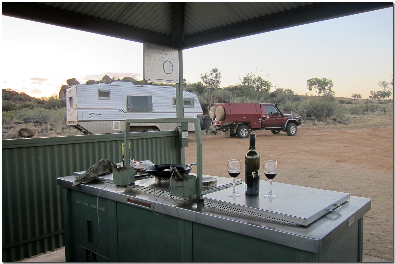
From here it was another boring bitumen road until we reached Walgett were we were going to stay for the evening. We stayed at the Apex Trevallion Park which is 2 Km's south of Walgett. There are bays for vans and areas for tents. The site has a tap with filtered water, rubbish bins, toilets and a dump point. Its in the Camps6 book #397 and its free.
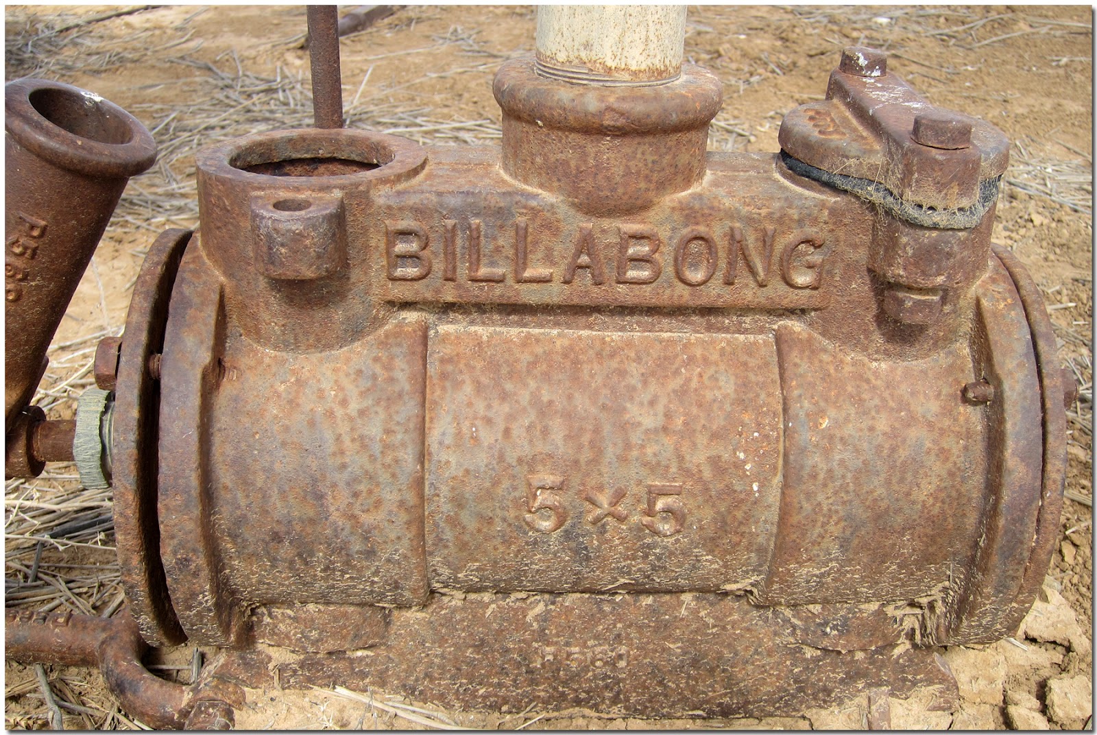
Displayed at the site is a "Ditch Digger" that was designed and patented by Frederick Worsley from Walgett in 1883 with the purpose of digging drains to move bore water into his paddocks for his sheep and cattle. The digger was pulled by a team of draught horses. The diggers were manufactured  in Melbourne but were too expensive to be successful. On one of his stations he dug 53 miles of bore drains.
 
Distance today 241 Km's Total distance 9133 Km's.
 
October 10:
We are off to spend the night at the Moree Showgrounds. We stopped for morning tea at Collarenebri just east of town on the Barwon River. There is just east of town another Primitive Campground just like the one at Walgett. This campground has similar amenities to Walgett but also has showers. It's in the Camps6 book #899.
Distance today 228 Km's Total distance 9461 Km's.
 
October 11:
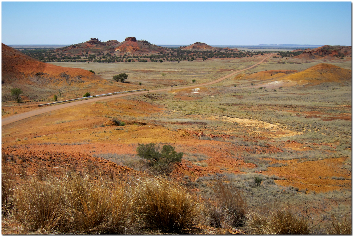
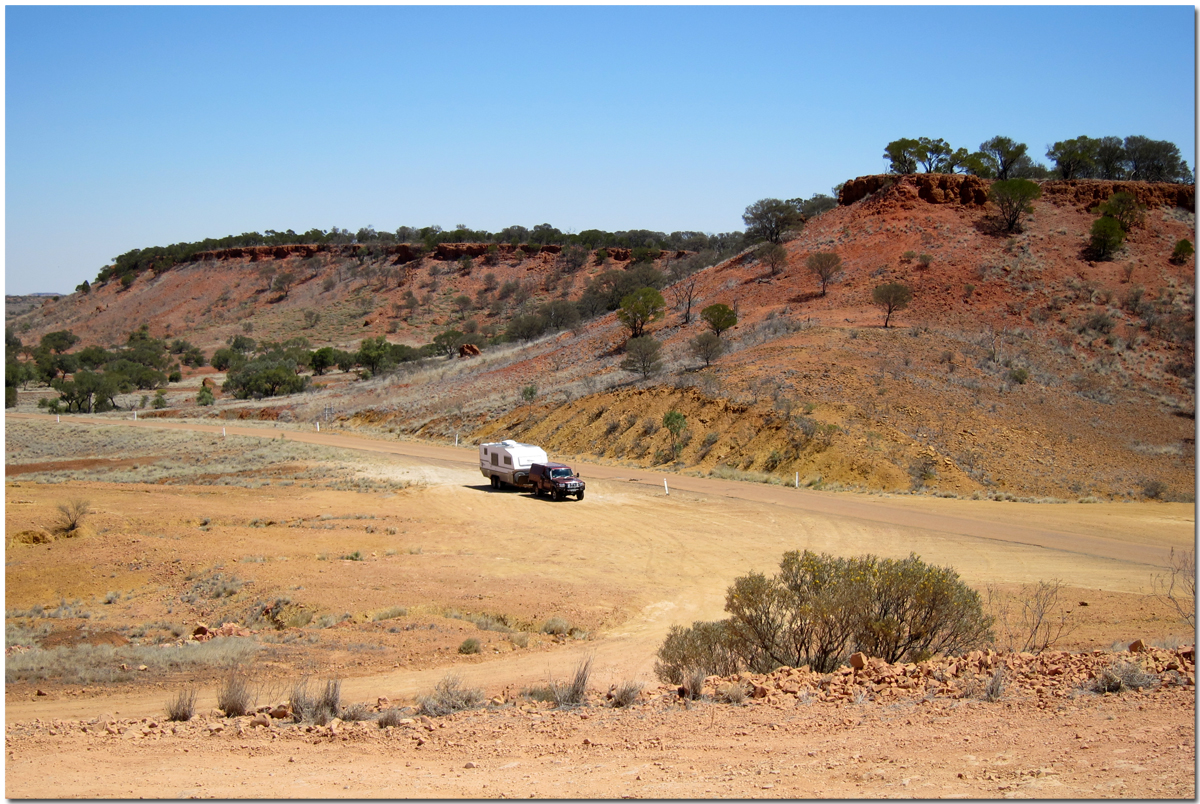
It started to rain early this morning and continued all day long and into the evening. We were off to spend the night at Jackadgery which lies between Glen Innes and Grafton on the Gwydir Highway and beside the Mann River. After leaving Glen Innes, we entered low clouds and fog as we passed through Washpool and Gibraltar Range National Parks before descending to the flats around Mann River.
Distance today 325 Km's Total distance 9786 Km's.
 
October 12:
We headed home on the last part of our trip with the rain disappearing and the sun shining. Headed east for 40 Km's before turning south for the run home on the Pacific Highway.
Distance today 150 Km's Total trip distance 9936 Km's.


Sunday, October 7, 2012

Longreach to Bourke

September 28:
The drive from Ilfracombe to Isisford was once again over single lane bitumen. Because we were travelling slower than single vehicles we were happy to move off the bitumen and give them right of way. It's just something we do along with ensuring we are not sprayed with stones as they pass by.
We stopped at the free camp just on the outskirts of Isisford for morning tea. The stop is right beside the Barcoo River and is a very large area with a number of campers strung out along the banks.
A change with cooler temperatures and rain associated with a front was heading our way. We were unsure of how much rain there would be so we decided to head towards Blackall. We camped just outside town on the Barcoo River with a mixture of black soil and grass under the van.
A fee of $5 per site per night also gives you access to flushing toilets and there is a dump point nearby. There were 9 other rigs here when we arrived. The area is the size of several football fields allowing plenty of space. We shopped and topped up our fuel tanks. The town's water supply is bore water from the Great Artesian Basin. There are very few hot water systems with water temperatures 58 to 62 degrees being fed directly to homes and businesses.
Distance today 246 Km's Total distance 7405 Km's

September 29:
We woke to a cool overcast morning. The change in temperature is a welcome relief considering the past 4 weeks temperatures have been above 36 degrees. We have had a few spits of rain this morning and the radar shows significant rain is falling all around us. Isisford appears to be getting more rain so our decision not to camp on the river was a good one. We are on a slight rise with about 400 metres of a mixture of grass and black soil before we are on the bitumen. Rain continued to fall during the afternoon with showers becoming more frequent and heavier. Several vans packed up and left to camp nearby on a large bitumen area. We watched the Swans win the AFL grand final which was just great to see.
Distance today 0 Km's

September 30:
No rain overnight. The black soil still has that tacky feeling to it and sticks to your boots and makes you feel as if you have grown inches taller. Lovely clear skies this morning so we are off to camp at Welford National Park.
The first 42 Km's is bitumen followed by 66 Km's of dirt before we reached Emmet.
There is just one house that was once a store, an assortment of old machinery and the disused railway station.
The line from Blackall to Emmet was opened in 1914 and there was a station master in charge until October 1998.
It's a further 51 Km's to Yaraka where the railway line was closed in October 2005 when livestock facilities were withdrawn.
A further 93 Km's saw us turning north onto the Quilpie to Jundah road that passes through Welford National Park. We camped at Little Boomerang Waterhole on the Barcoo River.
During the dry season the river is made up of individual waterholes but of course all that changes when the rains come and the whole area is covered by water. There was one other group camped when we arrived. Later in the afternoon before the sun began to set we drove out to look at the Desert and River drives. The desert drive highlighted spinifex and red sand dunes along with waterholes and bores.
The river drive was completely different focusing on the majestic river red gums along the Barcoo.
 
Distance today 325 Km's Total distance 7730 Km's.
 
October 1/2:
We are on our way to camp at Lake Houdraman just outside Quilpie. It's almost 12 months to the day that we camped here last. We had about 70 Km's of dirt to negotiate before reaching the Diamantina Development Road and turning south towards Quilpie.We pumped up our tyres and headed off on another single lane bitumen road. This one however for most of it's length was quite difficult to drive on. It is the channel country and when it rains the flood ways and bitumen are covered with water causing a rocking and bucking sensation as you drive over it. I'm sure it would be easier to travel over without the van connected.
 Distance today 278 Km's Total distance 7808 Km's.
 
October 3:
Tonight we camped on the Wilson River at Noccundra. Last time here we had come from Quilpie via Eromanga but decided to take a different route this time so we went south through Toompine and Thargomindah. It was a much longer distance but different scenery. The bitumen road was once again single lane bitumen but in far better condition than the road south from Windorah to Quilpie. Once we reached the sign welcoming us to the Bullo Shire the road turned to dirt for 50 Km's with the last 26 Km's into Thargomindah being bitumen. The hundreds of pelicans that were on the waterhole last time we were here have moved on with just 7 remaining this time.
 Distance today 347 Km's Total distance 8155 Km's.
 
October 4:
This morning we headed south towards the NSW border. The first 14 Km's on bitumen before the dirt. The dirt section for the first 70 Km's until we reached what was listed on our maps as the vermin fence was made up of gibber stones.
We stopped here for morning tea before continuing on with the road improving as we passed by the road junction to Barnsby and Naryilco stations. Just as we approached the turnoff to the Santos Orientos to Nappa Merrie road the surface changed to that dreaded hard clay based road that is set like bitumen but rough as all hell.
I'd rather drive on any other surface than that. We had this surface for the next 39 Km's until we reached the Warri Gate and the NSW border. This is also the dog fence that helps keep dingoes to the north protecting sheep and also red and grey kangaroos that inhabit Sturt National Park.
The Olive Downs campground is a further 14 Km's on and we thought we may spend the night here but the camp did not impress us much so we had lunch before driving south another 45 Km's,
 to camp at Dead Horse Gully campground just on the outskirts of Tibooburra. We were here in April 2011 and just like then we had the place to ourselves. Sturt national park does not allow fires but do provide very clean gas BBQ's, drop toilets and very clean untreated water that we topped up our non-potable tank with.
Distance today 242 Km's Total distance 8397 Km's.
 
October 5:
We fueled up at Tibooburra and headed 25 Km's east towards the Mount Wood pastoral museum where we walked around the open air display.
The pastoral relics included steam driven engines, an assortment of pumps, gold mining equipment and remains of the wool scour.
The Whim was a device for drawing water to the surface from depths of over 300 feet. Power was provided by either camel or horse.
The Whim was later replaced by the "Walking Beam" which was powered by a stationary steam engine and later by single cylinder petrol engines.
Wool was "scoured" or washed to remove dirt and impurities. By washing wool a weight reduction of up to 50% could be achieved which reduced freight costs to distant markets. It also improved appearance and texture and made the fleece more desirable. The wool scour operation began at Mount Wood 1897 and operated into the 1920's when motorised transport reduced costs.
The road east from Mount Wood for the first 100 Km's ranged between gibber strewn and my dreaded hard based clay surface but thankfully much kinder than yesterdays. The last 130 Km's into Wanaaring was a combination of sand and rocks and more pleasurable to drive on.
We stopped at the Wanaaring pub for a beer and to ask about camping on the Paroo River. We have a nice camp on a bend in the river just inside the levee bank and within walking distance to the pub. We went back up at 5pm for another couple of beers.
Distance today 249 Km's Total distance 8646 Km's.
 
October 6:
Today sees us heading further east to Bourke with just over 150 Km's of dirt. The whole dirt road was very corrugated and stony with some sections of corrugations quite severe. 4wd tire pressures were down to 28 and van down to 26 psi to help reduce and cushion contents and inhabitants. We were relived when we once hit the bitumen on the final stretch into Bourke. The roads leading south to Tara and Louth and signs out indicating that graders were on those roads but unfortunately we were not going that way. We are staying at the Kidman Camp caravan park with its lovely green grass under foot and a swimming pool to cool down in with yesterdays temperature of 37 degrees and a strong westerly wind blowing.
Distance today 190 Km's Total distance 8836 Km's.

October 7:
Cleaning and washing today. Then into town to shop followed by lunch at Diggers on Darling in Sturt Street.
Distance today 36 Km's Total distance 8872 Km's.

October8:
Shopped and filled tanks before we leave tomorrow for Walgett.
Distance today 20 Km's Total distance 8892 Km's.


Thursday, September 27, 2012

Mount Isa to Longreach

September 14:
We are on our way to Bouila. We plan to camp on the Burke River just out past the race course. The Diamantina Development Road consists of a single strip of bitumen with the occasional double lane for overtaking purposes.
Today's fuel economy was the worst for our trip so far with a reading of 19l/100Km's, as we were driving into a severe headwind for the whole journey.
We stopped at Dajarra for morning tea. The town was once the largest cattle railway trucking depot in the world, where large herds were driven to Dajarra from the Northern Territory and placed on trains bound for the east coast. The advent of huge road trains rendered this facility obsolete.
On arrival we found stretches of the river bed dry but after following tracks further along the bank we found a lovely stretch of water for our campsite where we set up for the night. Later in the afternoon another four groups arrived in camper trailers and were able to drive further along the river than we could with our van.
Distance today 312Km's Total distance 5635Km's.

September 15:
We left Bouila at 10am after fueling up and visiting the information centre. We had previously visited the Min Min Centre which is also housed in the same building. We turned east onto the Kennedy Development Road which was also single strip bitumen with overtaking lanes every 30 Km's. The Mitchell grass plains stretched away to the horizon on both sides of the road and were only broken by trees that lined the dry creeks we crossed. We stopped at the Hamilton Hotel ruins for morning tea which also has a new toilet facility and tank water.
Next stop was the Cawnpore Lookout where we had lunch and took photos. The scenery from the lookout and the road is quite spectacular. The Mesa formations and colours reminded us of the type of country portrayed in old western movies.
From here we only had a short drive to the Middleton Pub were we camped across the road for the evening. We spent about an hour talking to the publican while having a beer before settling in for the afternoon under some shade next to the van.
For the remainder of the afternoon another 4 vehicles stopped at the pub and just after 7pm a van arrived and camped near us for the evening. The Hotel was built during the Cobb & Co era and was a change station where tired horses were replaced with new ones. It formed one of the “Nine Pillars” of Cobb & Co. These Pillars represent the nine oldest and original change stations on the Winton to Bouila route which was 240 miles (384 Kilometres) and took four days each way. The contract was held between 1895 and 1915. The Pillars were Winton, Elderslie, Woodstock, Middleton, Makunda Hotel, Lucknow, Warenda Bore and Bouila.
An original Cobb & Co coach:
Imagine travelling on this suspension:
Distance today 202Km's Total distance 5837 Km's.
September 16:
We left early on our way to Winton where we stopped for morning tea at the information centre come Matilda Centre. We had previously taken the tour and can highly recommend it. We planned to spend the next few days camped at Carisbrooke Station run by Charles and Penny Phillott so we rang ahead to let them know we were coming. Penny informed us that with the higher temperatures they were now experiencing that we would have the place to ourselves. Just our sort of place!!
We left Winton with 260 litres of diesel on board as we planned to continue south to Diamantina National Park then onto Windorah. We headed west from Winton for 38 Km's before turning south onto the Old Cork Mail Road. We let down our type pressures on the 4wd and van and continued another 42 Km's to Carisbrooke. We were met by Charles who welcomed us and provided us with a mud map showing the different camping locations. Unpowered sites are $17 per night with spotless toilet and shower facilities and a very large tank of very nice drinking water. We camped near the old wool shed that also houses a camp kitchen. We spent the rest of the day settling in and relaxing. Charles has mud maps of the property that you can purchase and take a self drive tour.
Distance 259Km's Total distance 6096Km's.
September 17:
We opted to have Charles take us on a 4wd sunset tour at $40 per head. We can highly recommend this tour. It’s BYO drinks and Charles provides a nice selection of 'nibbles’.  First we  taken up onto the escarpment overlooking the property followed by a 30 minute return walk down into Python Gorge to view 1000 year old aboriginal rock paintings under a large overhang at the head of the gorge.
The tour was very informative as he pointed out different aspects around the station. We were able to view the “3 sisters formation” from many different angles and then as the sun began to set we were taken to another viewing point of the "sisters" where we watched a magnificent sunset whilst having a cold "crownie".
Distance today 0 Total distance 6096Km's.
September 18:
Today's drive is only 90 Km's. We are off to camp at the Old Cork Waterhole just down from the station named the same. The waterhole is several Km's long and several hundred metres wide and is a permanent waterhole on the Diamantina River. The old homestead is built on a rise overlooking the water. Old Cork was first settled in the 1860’s when pastoralists were applying for land along the Diamantina. The homestead was built between 1880 and 1885 with local sandstone and imported timber from SE Queensland.
We thought we would have the place to ourselves but just after 4pm 2 camper trailers arrived but camped a considerable distance from us.
Distance 90Km's Total distance 6186Km's.
September 19:
The drive south towards Diamantina National Park has some lovely scenery, especially the hills near the Mayne Hotel ruins.
 The hotel traded between 1888 and 1951 and was a popular resting place for travellers, stockmen and opal miners.
The drinks were kept cool in an underground cellar that was opened at night to let in the cool air and closed during the day to keep out the heat.
We entered the National Park which was once part of Diamantina Lakes Station and covered 507,000 hectares. It was a prized breeding and fattening property and during good years could support up too 12,000 head of cattle. It was gazetted a national park in 1992.
We set up camp at Hunters Gorge campground. We sat in the shade of the van with the strong wind gusts creating havoc with the dusty camp conditions. So much so that it was impossible to have any part of the van open otherwise it would have been filled with dust. When the wind finally died down at 4.30pm the van inside temperature was 41 degrees.
Another useful accessory to take to the national park is a fly net because without one of these you would go insane with the flies. We had run out of RID and only had Bushmaen and they just loved it.
Distance 148Km's Total distance 6334Km's.
 September 20:
We left at 7am to drive the 90 Km Warracoota Circuit drive. The drive takes you past red sand hills, gibber plains, grass lands, lakes and waterholes and sites that were once used when it was a grazing property. The sites we enjoyed included Lake Constance which now only fills when the floodwater levels reach 4.5 metres:
Warracoota waterhole which is another large body of water:
The Ruins which contain several loose stone-wall structures which are thought to have been a settler outpost:
Green Tank built in the 1980’s as a stock watering point. The 2011 floods damaged the dam wall minimizing its water storage capacity. The water here is much clearer than other waterholes in Diamantina because of the high level of gypsum in the surrounding soils. Gypsum was often added to tanks to clear the water:
 Gum Hole yards built using gidgee and coolabah which are some of Australia’s hardest timbers. The yards are made entirely of post and rail fencing.
And some lovely sand hills:
After finishing the drive we called into the other camp area known as "Gum Hole". It also has water views but was more suited to camper trailers and tents.
When we arrived back at our campsite at 11am the wind was stronger than yesterday and the temperature much worse so we decided to spend the remainder of the day in air-conditioned comfort. Sooo, we hitched up the van and headed south.
 We passed Davenport Downs and Palparara,
before turning east onto the Diamantina Development Road and finally stopping at 5.15 pm at the JC Hotel ruins site which was well of the main road and a very nice camp area. Yet again another place to ourselves.
Distance 415Km's Total distance 6749Km's.
September 21/22/23:
Today's drive to Windorah was once again on single lane bitumen. We stopped to purchase several items from the one and only small shop in the town and filled our 4th water tank from a tap near the store that had a sigh that said “feel free to use this filtered water from Coppers Creek” On the eastern side of Windorah is a solar farm that was commissioned in 2009. It has the capacity to produce  up to 360,000 kilowatt hours of electricity each year. This amount of electricity would otherwise have required 100,000 litres of diesel to be used by the towns generators.
Went to the local dump point before continuing south and camping down near the water and bridge on Coopers Creek.
Coopers Creek was named by Charles Sturt in 1845 and said; " Before we finally left the neighbour where our hopes had been so often raised and depressed. I gave the name of Cooper's Creek to that fine watercourse we had so anxiously traced,as proof of my respect for Mr Cooper, the judge of South Australia. I would gladly have laid this creek down as a river, but as it had no current I did not feel myself justified in doing so."
Some of the locals turned up with an open sided houseboat on a large trailer and proceeded to lower it into the water. They were off fishing and pig shooting for the weekend. I spoke with the owner who said they currently could travel 15 Km's up the creek from the bridge.
One of our many happy hours watching the sun set over Coopers Creek.
Distance 92 Km's Total distance 6841 Km's

September 24/25/26/27:
Currently in Longreach having the ute serviced, catching up on shopping and washing.
Distance 318 Km's Total distance 7159 Km's.