Wednesday, November 27, 2013

Disastrous Weather

November 16:
I played golf this morning just as I do every other Saturday. The forecast was for showers and storms to develop later in the day. We had been experiencing similar weather for many days beforehand, with late afternoon showers bringing thunder and lightning.
Our weather usually comes from the south, and once it reaches us, it tends to hug the Great Dividing Range to the west, with the worst of the weather affecting towns to the north, such as Ballina, Byron Bay, and Tweed Heads.
 
However, on this Saturday afternoon, the storms that battered Sawtell remained out over the ocean, and we experienced the worst weather the area has seen in many years. The storm lasted just over an hour, with twenty minutes of hail, some of which was the size of golf balls. We watched as the hailstones hammered down on our gardens, stripping leaves from trees, cracking windows, denting our awnings, and causing considerable damage to our Bushtracker.
 
Every surface on the van has been damaged, especially the top. It appears that someone has taken to it with a ball hammer; however, the four solar panels on the roof remained undamaged.
We are insured with CIL and have sent a series of photos to Bushtracker on the Sunshine Coast, who will provide CIL with a quote for repairs. A CIL assessor has inspected our van and informed me that we will need a complete re-skin.


Monday, November 18, 2013

Canberra to Sawtell

November 4:

A chilly five degrees inside the van this morning. Today we left Canberra after spending the past seven days camped at Exhibition Park. We had visited family and friends over the past week. Heading north along the Barton Highway, we passed through Murrumbateman. It is located 40 km north of Canberra and is surrounded by vineyards that produce cool climate wines. 

We joined the Hume Highway near Yass and headed west for 17 km before turning north onto Lachlan Valley Way. Passing through Boorowa, a small country town of just over a thousand people, before continuing on towards Cowra. Cowra is surrounded by farmland and is a wine-producing region known for its Chardonnay. During the Second World War, Cowra housed captured Japanese and Italian military personnel, and in 1944 Japanese POWS staged a breakout from the camp. This breakout became known as the Cowra Breakout. Some prisoners were killed, some committed suicide, and four Australians were killed.


We stopped in Molong for lunch at the local bakery before heading on to Yeovil. We prefer to take the less travelled road rather than major roads, but unfortunately, the road from Molong could best be described as a goat track and was in poor condition. We set up camp at the showground, which is listed in Camps 7, but there was no caretaker in residence, so we parked behind one of the tin sheds to shield ourselves from the strong winds we had experienced all day. There were toilets, taps, and power boxes, but we chose not to use any of the facilities since we hadn't paid. Like many places where we've camped, we had the entire area to ourselves, apart from several cows in the neighbouring field.


November 5:

A very chilly zero degrees this morning, with temperatures forecast to rise into the thirties and another day of thirty-plus km/h winds expected. Our plan was to camp at the showgrounds in Gulgong tonight, but we've now decided to spend three nights camped at Arakoon, across the bay from South West Rocks, so it was off to camp at Jerry's Plains in the Hunter Valley. The 40 km of road from Yeovil to Wellington was in a similar condition to the goat track we travelled on yesterday. Here, we emptied our toilet cassette at the showgrounds and then refuelled at $159.9 cpl before stopping in Gulgong for morning tea. We passed through Ulan, with its open-cut and underground coal mines, before turning east onto the Golden Highway. The wind forecast proved correct, and for most of the day, we faced a severe headwind. We encountered a semi-trailer 15 km west of Denman, carrying a seven-metre-wide load, and followed it until it pulled over at Denman Gap, allowing the now large queue of vehicles to pass.


November 6-8:
Nine degrees at 6:30 with some fog in the surrounding valleys and lovely blue skies. Thankfully, the strong winds we experienced over the past three days now seem to have abated. We passed through Maitland 80 km later and turned north at Hexham before refuelling at Raymond Terrace at 159.9 cpl. From here, we had a straightforward journey north to Arakoon and arrived just after 1:00. We have a lovely site overlooking the bay to South West Rocks.


Tuesday, October 29, 2013

Heading East to Canberra

October 22:

We were leaving Margaret River today and heading down the south coast for the next four weeks, but everything changed with just one phone call that woke us at 6:00. The news that a very close and dear friend had passed away unexpectedly the night before at the tender age of fifty-seven. The family live in Canberra, and we camped with them earlier this year at Arakoon, just as we do each year. With this sad news, we both agreed that we could not enjoy the rest of our holiday but would instead head for Canberra to be with the family for the funeral. We had planned to have lunch today with "Motherhen" in Bridgetown, but of course, we didn't have time to stop and socialise, so that was unfortunately cancelled. We headed east through Nannup, Bridgetown, Boyup Brook, Kojonup, Bromehill, and Jerramungup before spending the night just west of Ravensthorpe in the bush.


Distance today: 573 km.

October 23:

Ten degrees in the van this morning before receiving another call confirming the funeral arrangements for Wednesday, October 30. We left shortly after and stopped in Esperance for a coffee before heading north to Norseman for lunch and to refuel. We still had another 167 km to travel today. Our camp for the evening is Harms Lake, and upon arrival, we found several other vans already parked for the night.


Distance today: 553 km.

October 24:
Twelve degrees inside the van this morning under an overcast sky. We have another long day ahead and will cross into South Australia late this afternoon to camp at a scenic lookout along the Great Australian Bight. We were on the road by 7:00 and stopped at Balladonia, 25 km further on, to refuel before continuing east. The information given to us at the Norseman Information Centre the day before was that we would have a tail wind as we headed east. How wrong they were— we had a quite severe head wind until we stopped driving at 6:00 that evening. We faced the van into the wind and sat inside, watching the Southern Ocean while having our first Sailor Jerry Spiced Rum for the evening. Our site was 80 km west of the Western Australian border, and there was another van camped nearby.


Distance today: 645 km.

October 25:
Another cool morning with just eleven degrees inside the van at 5:30. Thankfully, the winds we experienced yesterday were much lighter today. We purchased fuel at Nullarbor for $2.02 per litre before continuing on. We emptied our toilet cassette at Ceduna and purchased diesel at $1.69 per litre before heading further east. It was wheat harvest time, and we had to contend with B-doubles carting wheat to the silos until we stopped for the night at the Apex Park in Minnipa. The entire camp area was strewn with rubbish, including large amounts of toilet paper, so it was time to put on the rubber gloves. When I finished, I had filled a large green garbage bag. Ros then bought me a very cold Little Creatures Pale Ale for my efforts.

Distance today: 567 km.

October 26:
Ten degrees inside the van at 6:30 this morning, with a light breeze and clear skies. We left our camp at 7:30, continuing east along the Eyre Highway towards Port Augusta, where we refuelled before turning south. When we were level with Port Pirie, we turned inland, passing through Hughes Gap and stopping for lunch at Gladstone. We had planned to camp at Burra Gorge this evening, but with so much more daylight available, we decided to travel to Morgan, where we crossed the Murray River on the car ferry and camped at the Cadell Recreation Ground for $20.00 per site. The amenities were brand new and included a dump point. Because the temperatures were so mild, we sat outside the van for our happy hour and then cooked outside on our gas ring. Ros had lamb cutlets and I had porterhouse steak, which we bought at Margaret River. This was served with mashed potatoes, onions, and peas, and, of course, another bottle of red wine.

Distance today: 587 km.

October 27:

A lovely warm seventeen degrees at 5:30 this morning with light rain falling. Willy Weather predicts light rain clearing later, with winds from the south-west, so it looks like another day driving into the wind. The rain cleared as we left our campsite, and we experienced wet roads for the next 30 km until we reached Waikerie. We refuelled in Renmark and then Balranald before continuing east towards Hay on the Sturt Highway. We thought we might camp at one of the many sites along the Murrumbidgee River, but we had already covered so many kilometres today and driven for 7.2 hours, so we called it a day and camped at the showgrounds in Hay. $17.00 per site with power, showers, and toilets. Best of all, we had the place to ourselves. Another warm evening, so once the flies had departed, we cooked our meal outside again, with those wonderful meats from Margaret River.


This fountain commemorates the existence of a Prisoner of War camp in Hay from 1940 to 1946, which detained interns and prisoners of the Japanese and Italian forces. It served as the headquarters for the POW group of three camps, each housing 1000 men.


Distance today: 535 km.

October 28:
We experienced light rain falling on the van during the early hours of this morning. At 6:00, it was seventeen degrees. The showground also houses the race track, and Ros joked this morning about whether we would see any horses doing track work. I commented that it's not Royal Randwick, but low and behold, while we were having our coffee, a 4wd was being driven around the track with a horse tethered to the side of the vehicle. Rain started to fall as we left the showground and continued for the next 177 km until we reached Narrandera. From there, it was an easy run through Wagga Wagga and onto the Hume Freeway. We stopped for lunch at Yass before setting up camp at Exhibition Park in Canberra. Fees for a powered site are $30.00, which includes all the usual amenities and a dump point. It's situated just off the Federal Highway near the northern suburb of Watson.

Distance covered today: 503 km.


Sunday, October 27, 2013

Margaret River

October 18:
Eighteen degrees inside the van at 7:00 this morning. Another lovely day with clear blue skies. We left the caravan park at Karrinyup at 9:30, hoping to avoid the busy rush of people heading into Perth for work. We turned onto the Mitchell Freeway, which took us past the city and across the Swan River. The further south we went, the more clouds appeared, and after passing the Mandurah turnoff, we experienced light rain that became heavier around the turnoff to Bunbury. As we approached the bypass road at Busselton, the rain cleared, and the sky brightened with patches of blue.
We passed through Cowaramup before driving through Margaret River and turning onto Rosa Brook Road, which we followed for 7 km before turning onto a dirt track for the last 2 km to our camp. We are camping at the Big Valley Campground. It's surrounded by lovely green hills and is on a working sheep farm.
Distance today: 318 km. 


Their website is www.bigvalleymargaretriver.com.au, and bookings are essential. There is power, a dump point, showers, and toilets. After setting up camp, we drove back into Margaret River and wandered around the town before having a coffee. Then, it was onto Margaret River Gourmet Meats in the main street. My Godson, Robert, recommended that I go there, firstly because he knows them and secondly because they have the best meat, especially their Wagyu burgers. Along with the burgers, we purchased a leg of lamb, porterhouse and scotch fillet steaks, lamb cutlets, and pork chops.
We cooked some of the burgers over the fire on our Oz Pig that night, and they were so delicious that we will be returning for more before we leave.


October 19:

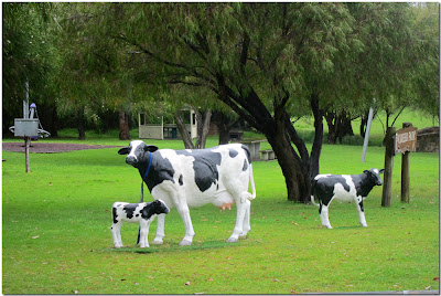
We woke to fourteen degrees inside the van with light rain falling. The rain had started in the early hours of the morning, and the weather forecast suggests it will continue throughout the rest of the day. We drove north today, back through Cowaramup. The town lies at the centre of the Margaret River wine region. There are life-sized fibreglass cows along the main streets and in the parks, and it's not just any 'udder' town.


From here, it was onto the Grove Liqueur Factory. We had sampled some of their liqueurs whilst in Perth, and we were here to purchase. We tasted many, but finally agreed on the Turkish Delight and Butterscotch.


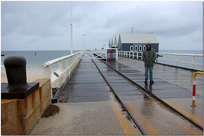
Then we headed to Busselton, which lies on Geographe Bay and has a population of 25,000. We came here to see the famous jetty and the underwater observatory. The jetty extends 1.8 km into the bay and is the longest timber-piled jetty in the Southern Hemisphere. Unfortunately, we didn't get to see it at its best due to the rain and overcast skies. We each bought a $28.00 ticket to take the tram ride to the end of the jetty, which also included a guided tour.


Later, we had a nice lunch at the Equinox Cafe that overlooks the bay. From here, we passed through Dunsborough to view the Cape Naturaliste Lighthouse, which is in Leeuwin-Naturaliste National Park. Unfortunately, we were unable to appreciate the beauty of the area due to the cloud cover and constant rain.


We continued south on Caves Road but ultimately gave up due to the rain and returned to our campsite. Distance today: 185 km.
 
October 20:
Eleven degrees inside the van at 7:00 this morning before turning on the heater. It rained throughout the night, and when we woke, there were patches of blue sky, though these appeared and disappeared just as quickly. This morning, we visited the Margaret River Nougat Factory, the Dairy Factory, the Chocolate Factory, and Miller's Ice Cream Farm Shop. After lunch, we visited the Colonial Brewery, where we sampled seven of their beers. We both agreed that the Pale Ale was our favourite.


October 21: Another eleven degrees this morning at 7:00 with cloudy skies. The heater soon raised the temperature to a reasonable seventeen degrees by 8:15. We drove into Margaret River to buy more of those Wagyu burgers before heading south and passing through Karridale and then Augusta. We were on our way to see the Cape Leeuwin Lighthouse that sits at the very south-west corner of Western Australia. The sky remained cloudy, and the wind was quite cool, but thankfully there was no rain. The lighthouse stands at the point where the Southern and Indian Oceans meet and protects ships from the many reefs and small islands nearby. After taking photos and doing the audio tour, we stopped for lunch in the cafĂ© of one of the old caretaker's cottages.


  It was then onto viewing the water wheel, which, over time, has become encrusted with calcified lime. The wheel was built in 1895 to supply water for the builders of the lighthouse. The water originates from a natural spring and continues to flow today.


 We then travelled to Hamelin Bay to see the jetty. It was once used to export timber to England, South Africa, and India, and many of the streets in London are still paved with Karri from the forests around Boranup and Karridale. As the demand shifted to Jarrah instead of Karri, the jetty was abandoned and fell into disrepair. Distance today: 139 km.