Distance today: 214 km.
Sunday, September 15, 2013
Cobar to Peterborough
Distance today: 214 km.
Friday, September 13, 2013
Heading West
September 11:
After weeks of preparation, our van was fully packed, and we were eager to hit the road this morning. It's just under twelve months since our last extended trip away into Northern and Western Queensland, but it feels much longer than that. We overcame the monotony of driving south along the freeway for nearly 300 km. We passed Kempsey with its wonderful new bypass road completed earlier this year, then moved past Taree and used the new bypass at Bulahdelah, before turning west at Hexham to travel through Maitland and Singleton. Tonight, we are camping at Jerry's Plains Recreation Ground, where we found two other vans upon arrival. It's listed in Camps7 #201.
Distance today: 463 km.
Wednesday, February 27, 2013
Arakoon National Park
We have just returned home after visiting friends from Canberra. We were camping at Arakoon National Park, which is located just over 100 km south of our home. We also aim to camp there at least once every year.
Unfortunately, we couldn't have picked a worse time to be away. While we were camping, much of the east coast was affected by an intense low-pressure system. This system brought gale-force winds along the coast, heavy rainfall causing flash flooding of the Macleay River, and very rough seas. We were stranded and unable to return because the Pacific Highway was closed in several places.
The campground at Arakoon is situated on the bay side of Laggers Point, on a strip between the beach and the historic Trial Bay Gaol, facing the town of South West Rocks across the bay. The gaol and the trees along the seafront provide protection for the camping area from the worst of the weather blowing in from the ocean.
A few kilometres south of Arakoon is Smoky Cape Lighthouse in Hat Head National Park. Smoky Cape was named by Captain Cook in 1770 because of the large amount of smoke from Aboriginal burn-off fires on the headland. The lighthouse was completed in 1891 and is now fully automated.
The complex of buildings consists of the lighthouse, the head keeper's residence, the assistant keepers' residence, and stables. The residences have been refurbished and are now available for rent.
Sunday, October 14, 2012
Bourke to Home
Left Bourke just after 9am heading towards Brewarrina were we stopped for morning tea near the old lift bridge that crossed the Barwon River.
Sunday, October 7, 2012
Longreach to Bourke
The drive from Ilfracombe to Isisford was once again over single lane bitumen. Because we were travelling slower than single vehicles we were happy to move off the bitumen and give them right of way. It's just something we do along with ensuring we are not sprayed with stones as they pass by.
We stopped at the free camp just on the outskirts of Isisford for morning tea. The stop is right beside the Barcoo River and is a very large area with a number of campers strung out along the banks.
A change with cooler temperatures and rain associated with a front was heading our way. We were unsure of how much rain there would be so we decided to head towards Blackall. We camped just outside town on the Barcoo River with a mixture of black soil and grass under the van.
A fee of $5 per site per night also gives you access to flushing toilets and there is a dump point nearby. There were 9 other rigs here when we arrived. The area is the size of several football fields allowing plenty of space. We shopped and topped up our fuel tanks. The town's water supply is bore water from the Great Artesian Basin. There are very few hot water systems with water temperatures 58 to 62 degrees being fed directly to homes and businesses.
Distance today 246 Km's Total distance 7405 Km's
September 29:
We woke to a cool overcast morning. The change in temperature is a welcome relief considering the past 4 weeks temperatures have been above 36 degrees. We have had a few spits of rain this morning and the radar shows significant rain is falling all around us. Isisford appears to be getting more rain so our decision not to camp on the river was a good one. We are on a slight rise with about 400 metres of a mixture of grass and black soil before we are on the bitumen. Rain continued to fall during the afternoon with showers becoming more frequent and heavier. Several vans packed up and left to camp nearby on a large bitumen area. We watched the Swans win the AFL grand final which was just great to see.
Distance today 0 Km's
September 30:
No rain overnight. The black soil still has that tacky feeling to it and sticks to your boots and makes you feel as if you have grown inches taller. Lovely clear skies this morning so we are off to camp at Welford National Park.
The first 42 Km's is bitumen followed by 66 Km's of dirt before we reached Emmet.
There is just one house that was once a store, an assortment of old machinery and the disused railway station.
The line from Blackall to Emmet was opened in 1914 and there was a station master in charge until October 1998.
It's a further 51 Km's to Yaraka where the railway line was closed in October 2005 when livestock facilities were withdrawn.
A further 93 Km's saw us turning north onto the Quilpie to Jundah road that passes through Welford National Park. We camped at Little Boomerang Waterhole on the Barcoo River.
During the dry season the river is made up of individual waterholes but of course all that changes when the rains come and the whole area is covered by water. There was one other group camped when we arrived. Later in the afternoon before the sun began to set we drove out to look at the Desert and River drives. The desert drive highlighted spinifex and red sand dunes along with waterholes and bores.
The river drive was completely different focusing on the majestic river red gums along the Barcoo.
We are on our way to camp at Lake Houdraman just outside Quilpie. It's almost 12 months to the day that we camped here last. We had about 70 Km's of dirt to negotiate before reaching the Diamantina Development Road and turning south towards Quilpie.We pumped up our tyres and headed off on another single lane bitumen road. This one however for most of it's length was quite difficult to drive on. It is the channel country and when it rains the flood ways and bitumen are covered with water causing a rocking and bucking sensation as you drive over it. I'm sure it would be easier to travel over without the van connected.
Tonight we camped on the Wilson River at Noccundra. Last time here we had come from Quilpie via Eromanga but decided to take a different route this time so we went south through Toompine and Thargomindah. It was a much longer distance but different scenery. The bitumen road was once again single lane bitumen but in far better condition than the road south from Windorah to Quilpie. Once we reached the sign welcoming us to the Bullo Shire the road turned to dirt for 50 Km's with the last 26 Km's into Thargomindah being bitumen. The hundreds of pelicans that were on the waterhole last time we were here have moved on with just 7 remaining this time.
This morning we headed south towards the NSW border. The first 14 Km's on bitumen before the dirt. The dirt section for the first 70 Km's until we reached what was listed on our maps as the vermin fence was made up of gibber stones.
We stopped here for morning tea before continuing on with the road improving as we passed by the road junction to Barnsby and Naryilco stations. Just as we approached the turnoff to the Santos Orientos to Nappa Merrie road the surface changed to that dreaded hard clay based road that is set like bitumen but rough as all hell.
I'd rather drive on any other surface than that. We had this surface for the next 39 Km's until we reached the Warri Gate and the NSW border. This is also the dog fence that helps keep dingoes to the north protecting sheep and also red and grey kangaroos that inhabit Sturt National Park.
The Olive Downs campground is a further 14 Km's on and we thought we may spend the night here but the camp did not impress us much so we had lunch before driving south another 45 Km's,
to camp at Dead Horse Gully campground just on the outskirts of Tibooburra. We were here in April 2011 and just like then we had the place to ourselves. Sturt national park does not allow fires but do provide very clean gas BBQ's, drop toilets and very clean untreated water that we topped up our non-potable tank with.
We fueled up at Tibooburra and headed 25 Km's east towards the Mount Wood pastoral museum where we walked around the open air display.
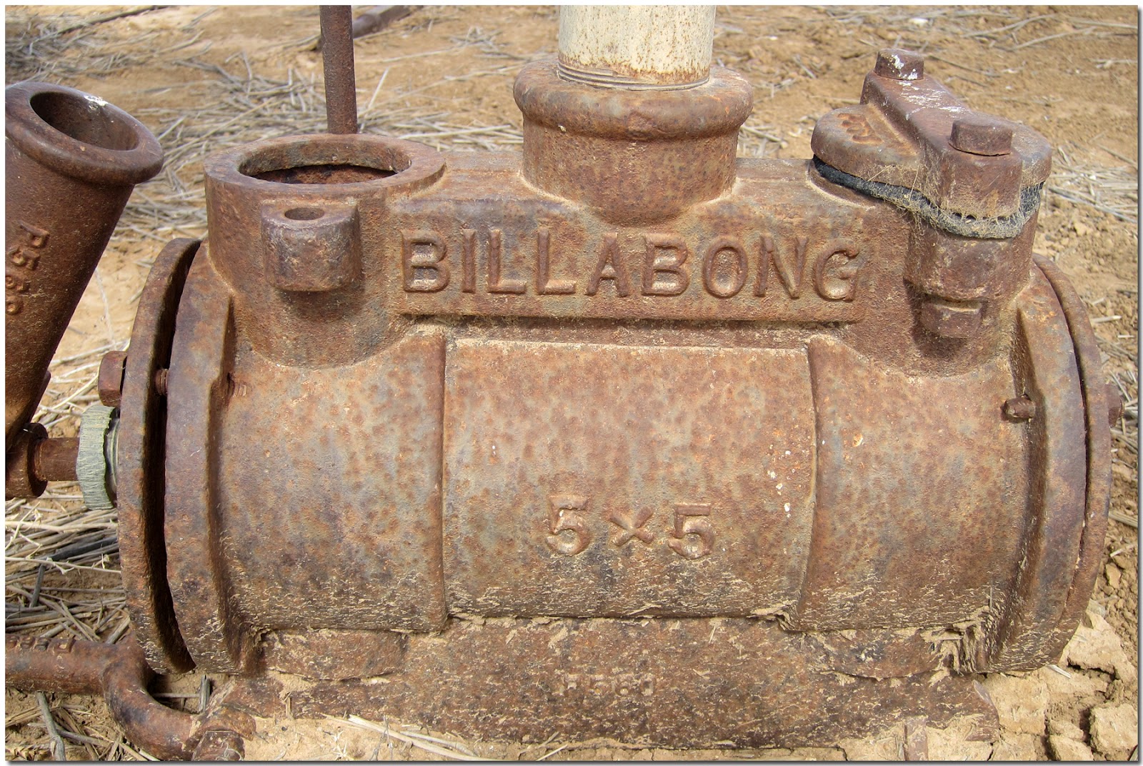
The pastoral relics included steam driven engines, an assortment of pumps, gold mining equipment and remains of the wool scour.
The Whim was a device for drawing water to the surface from depths of over 300 feet. Power was provided by either camel or horse.
The Whim was later replaced by the "Walking Beam" which was powered by a stationary steam engine and later by single cylinder petrol engines.
Wool was "scoured" or washed to remove dirt and impurities. By washing wool a weight reduction of up to 50% could be achieved which reduced freight costs to distant markets. It also improved appearance and texture and made the fleece more desirable. The wool scour operation began at Mount Wood 1897 and operated into the 1920's when motorised transport reduced costs.
The road east from Mount Wood for the first 100 Km's ranged between gibber strewn and my dreaded hard based clay surface but thankfully much kinder than yesterdays. The last 130 Km's into Wanaaring was a combination of sand and rocks and more pleasurable to drive on.
We stopped at the Wanaaring pub for a beer and to ask about camping on the Paroo River. We have a nice camp on a bend in the river just inside the levee bank and within walking distance to the pub. We went back up at 5pm for another couple of beers.
Distance today 190 Km's Total distance 8836 Km's.
October 7:
Cleaning and washing today. Then into town to shop followed by lunch at Diggers on Darling in Sturt Street.
Distance today 36 Km's Total distance 8872 Km's.
October8:
Shopped and filled tanks before we leave tomorrow for Walgett.
Distance today 20 Km's Total distance 8892 Km's.