Saturday, February 15, 2025

Tarkine Forest Drive - North West Tasmania

 The Tarkine region's wilderness consists of a cool temperate rainforest, the second largest in the world, covering over 400,000 hectares. 

It was 45 km from our campsite in Stanley to the start of the Tarkine forest loop road. This road is narrow and sealed, but some attractions that branch off from it have unsealed sections that are all in good condition and don't require 4WD.

Overall, I found the day very tiring, especially the drive from one point to the next. The road took many twists and turns, up and down, and some people did not stay on their side of the road. At one stage, we were confronted by a logging truck taking a corner on our side of the road, forcing us to move over into the scrub, but at least he apologised.

Along this loop, the points of interest include Trowutta Arch Milkshake Hills, Lake Chisholm, Julius River Forest Reserve, and Sumac Lookout.

The walk to the Towutta Arch is five hundred metres through a lovely forest, including large trees and giant ferns.

The larger ferns that grow throughout the Trakine can live up to 1000 years. They grow very slowly, from one to ten centimetres per year. They can go to fifteen metres but generally grow between four and a half to five metres.


This unnamed sinkhole was beside the road with a small get-off, so we could film this feature. Fortunately, the wind did not affect it.


It was windy, and unfortunately, the Lake Chisholm Sinkhole, which is probably the size of two football ovals, was affected by this wind. I could only imagine how beautiful this would be, reflecting the surrounding trees on its surface.


It was a lovely walk into Lake Chisholm, with the path surrounded by small ferns. 


The Arthur River below is seen from the Sumac Lookout.

Wednesday, February 12, 2025

Woolnorth Tour

 We prebooked our tour with Laura from Woolnorth Tours because we heard it was popular. Unfortunately, the weather wasn't ideal, but we set off from Stanley to drive one hour to the pickup point and hop aboard her mini-bus, which would take us through several locked gates.


The Woolnorth property was initially owned by the Van Diemens Land Company in 1826. Its chief Agent, Edward Curr, was responsible for the company and started the construction of Highfield House, which overlooks Godfreys Beach and the Nut at Stanley. George IV initially granted the company 350,000 acres.


The $90 per person tour is the only way to access the Northwest Cape and Cape Grim.

The tour also allowed us to visit the Bluff Point and Studland Bay wind farms. The more than forty staff members who work permanently on-site to keep the turbines in working order have given Laura a wealth of knowledge about their operation. This work includes cleaning the blades, removing rust from the towers, and repairing or replacing the motors that the blades are attached to. 


Morning tea was served in the shearing shed, which is no longer used. It was surrounded by quad bikes in the paddock, which were no longer used.


Matthew Flinders named Cape Grim, the two small islands called the Doughboys, and the wild and untamed part of Tasmania in 1798. Laura discusses the cape's Indigenous history and the subsequent massacre of Aboriginals there.


Laura also explained the operation of the Cape Grim Baseline Air Pollution Station, which monitors and records uncontaminated air from across the Southern Ocean. The nearest landmass is 19,800 km away at Cape Horn, on the tip of South America. There are only three of these premier stations in the world: this one at Cape Grim, Mauna Loa in Hawaii and Alert in the Canadian Arctic. Cape Grim constantly has the cleanest air, thanks to the fewer land masses in the south.

Wednesday, February 5, 2025

Burnie and Around

After leaving Cradle Mountain, we took a short leisurely drive down to the coast to our next destination, Cooee Point Reserve, just west of Burnie.
 We'd prebooked a free site through their website for a permit to stay for a maximum of two nights. Drinking water is available and a dump point for those requiring it. 


Unfortunately, the site is not monitored, and people in tents and slider vans with no facilities stay and use the few small trees and shrubs as their toilets. Those in caravans throw their water onto the ground with little respect for the site's leaving-no-trace policy.

After setting up, we drove to Burnie, walked around the town centre and watched a surf carnival. The water would be too cold for us, but they are used to it.

The town centre has some lovely old buildings, but many businesses have closed, leaving the place tired and rundown.

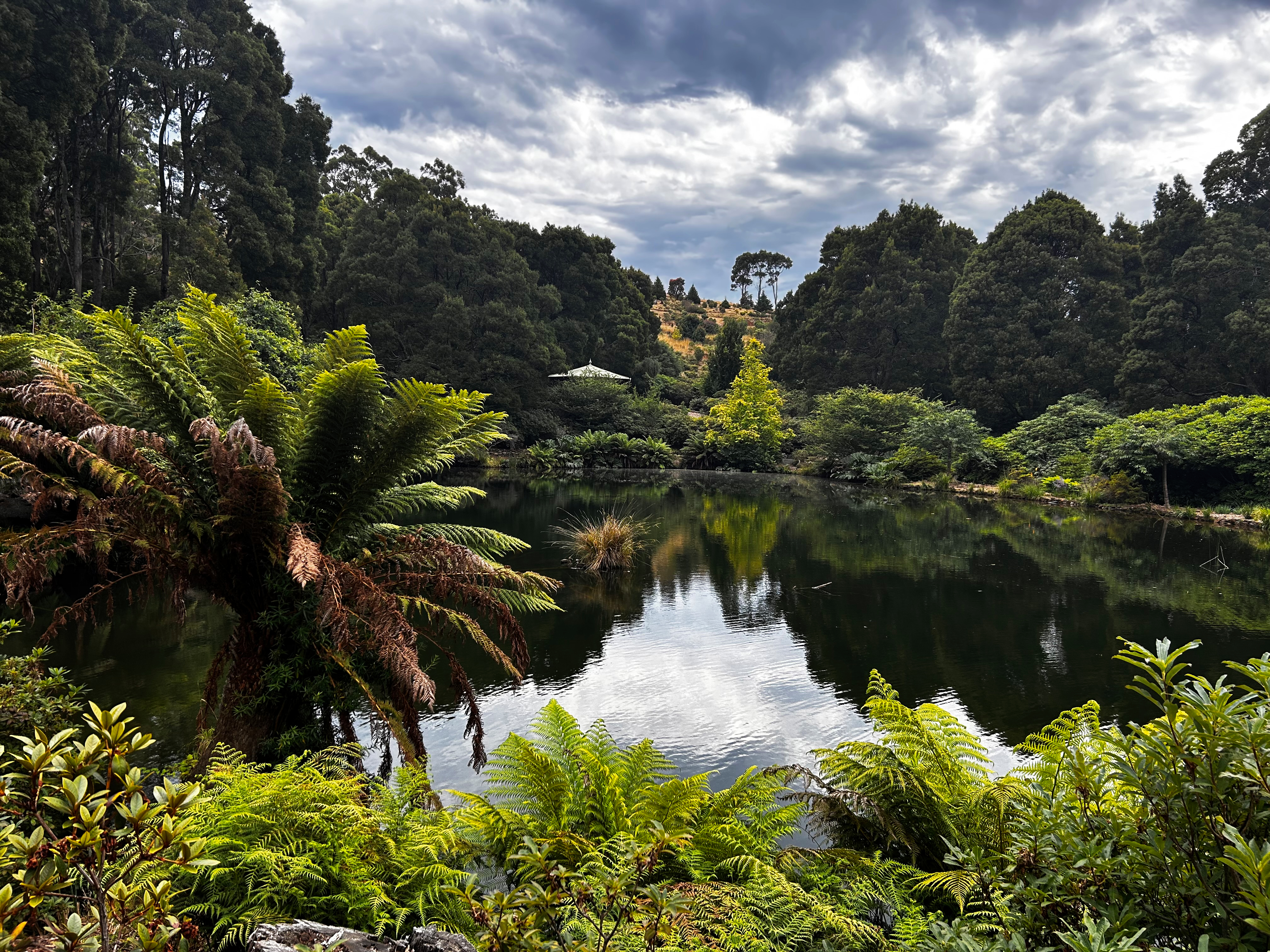
We stocked up at the local Woolies on our second day before driving to the Emu Valley Rhododendron Gardens. The site, which covers 11 hectares or 23 acres, was donated and is now run by volunteers with rhododendrons worldwide. There are three large lakes, and we saw a very elusive platypus that surfaced, but our photos don't do justice.


The lady who took our money said that we may encounter tiger snakes while doing the walk and just to calmly walk past them. Wow, no way was that going to happen, so after seeing our first snake, I decided to leave. By the way, Ros didn't disagree. It's not a particularly good photo, but I wouldn't stop and take a better one.

Saturday, February 1, 2025

Cradle Mountain check in Wednesday 29th January

 After our recce to Cradle Mountain two days beforehand, we had determined our route via the Bass, Ridgley and Murchinson Highways. Before booking, checking the weather conditions for these days, we booked four nights. While there, we also checked out our premium-powered gravel site to see if it suited us. Site 41 will do just fine. But at $84.50 per night, it's the dearest we've ever paid for a caravan site. 


With check-in at 2pm, I called the park, which advised that because we were on a powered site, they indicated that checking in earlier would not be a problem. We had a leisurely start before driving through Latrobe and onto the Bass Highway to head west and take the Ridgley and Murchison Highways.

Arriving at 11:45, we set up, enjoyed a beer with lunch, and headed towards the visitor centre to purchase our bus tickets at $30 each. Some walks, like the Dove Lake Circuit, are eight kilometres from the centre, so it's impossible not to buy this ticket. That afternoon, we walked along the Enchanted Walk, a 20-minute circuit that leaves from the Interpretation Centre Ranger Station, and then the King Billy Walk. This 40-minute circuit takes you through a rainforest with large, old King Billy pines. Pencil Pine Falls are at the start of the Enchanted Walk.


We had another beer on our return while sitting in the sun, followed by an early dinner of sausages and vegetables cooked on our gas COBB cooker, and then we retired into the warmth of the van.

On our first morning, the temperature inside the van was 8.7 degrees compared to 5.3 outside. Our weather app said it felt like 1 degree. So we turned on our diesel heater and lay in bed until the temperature increased to 16 degrees before making a move and brewing some coffee, followed by breakfast.

Then, we went to the Visitor Centre to catch the eight-kilometre shuttle bus to the Dove Lake dropoff point. The Dove Lake circumnavigation is 6.5 km long, and walking clockwise is recommended. The track includes gravel steps and all-weather boardwalks with steeper sections. Light, misty rain cleared after we started the walk, but the weather remained overcast. The peaks of Cradle Mountain were occasionally covered in clouds, and a cold wind blew on the exposed parts of the walk. 


At the end of the trail is the Boat Shed, built in 1940, and from here, it's a short walk back to catch the shuttle bus.


After another cold morning, the temperature was just one degree warmer than yesterday's. With blue skies forecast for our second day, we decided to head back to Dove Lake to photograph Cradle Mountain and the Boat Shed. 

We took the shuttle bus to the Ronny Creek dropoff point for a different track this time. The famous six-day Overland track begins from this location.


We walked some boardwalks before exiting to view the Waldheim (meaning forest home) Chalet, built in 1910 by Gustav and Kate Weindorfer. After a fire, the original chalet was demolished in 1976 but reconstructed using King Billy Pine shingles.


We then crossed Lilla Creek and continued toward Dove Lake along the Lake Lilla Track.


This track started with boardwalks but progressively got worse and much narrower the closer we got to Lake Lilla. It continued like this until we were almost at Dove Lake.


Lake Lilla with Cradle Mountain in the background.