September 14:
We are en route to Bouila. Our plan is to camp by the Burke River just beyond the racecourse. The Diamantina Development Road consists of a single strip of bitumen, with the occasional double lane for overtaking.
We are en route to Bouila. Our plan is to camp by the Burke River just beyond the racecourse. The Diamantina Development Road consists of a single strip of bitumen, with the occasional double lane for overtaking.


September 15:
We left Bouila at 10am after fuelling up and visiting the information centre. We had previously visited the Min Min Centre, which is also housed in the same building. We turned east onto the Kennedy Development Road, a single strip of bitumen with overtaking lanes every 30 kilometres. The Mitchell grass plains stretched to the horizon on both sides of the road and were only broken up by trees lining the dry creeks we crossed. We stopped at the Hamilton Hotel ruins for morning tea, which also has new toilet facilities and a tank water supply.
We left Bouila at 10am after fuelling up and visiting the information centre. We had previously visited the Min Min Centre, which is also housed in the same building. We turned east onto the Kennedy Development Road, a single strip of bitumen with overtaking lanes every 30 kilometres. The Mitchell grass plains stretched to the horizon on both sides of the road and were only broken up by trees lining the dry creeks we crossed. We stopped at the Hamilton Hotel ruins for morning tea, which also has new toilet facilities and a tank water supply.


An original Cobb & Co coach:

Imagine travelling on this suspension:

September 16:
We left early on our way to Winton, where we stopped for morning tea at the Matilda Centre, also known as the information centre. We had previously taken the tour and can highly recommend it. We planned to spend the next few days camped at Carisbrooke Station, run by Charles and Penny Phillott, so we rang ahead to let them know we were coming. Penny informed us that, with the higher temperatures they were now experiencing, we would have the place to ourselves. Just our sort of place!
We left Winton with 260 litres of diesel onboard, as we planned to continue south to Diamantina National Park and then onto Windorah. We headed west from Winton for 38 km before turning south onto the Old Cork Mail Road. We lowered our tyre pressures on the 4WD and van and continued another 42 km to Carisbrooke. We were met by Charles, who welcomed us and provided a mud map showing the different camping locations. Unpowered sites are $17 per night, offering spotless toilet and shower facilities, as well as a large tank of excellent drinking water. We camped near the old wool shed, which also houses a camp kitchen. We spent the rest of the day settling in and relaxing. Charles has mud maps of the property that you can purchase for self-drive tours.


September 17:
We decided to have Charles take us on a 4WD sunset tour at $40 each. We highly recommend this tour. It’s BYO drinks, and Charles offers a lovely selection of 'nibbles’. First, we were taken up onto the escarpment overlooking the property, followed by a 30-minute walk back down into Python Gorge to see 1000-year-old Aboriginal rock paintings under a large overhang at the head of the gorge.


September 18:
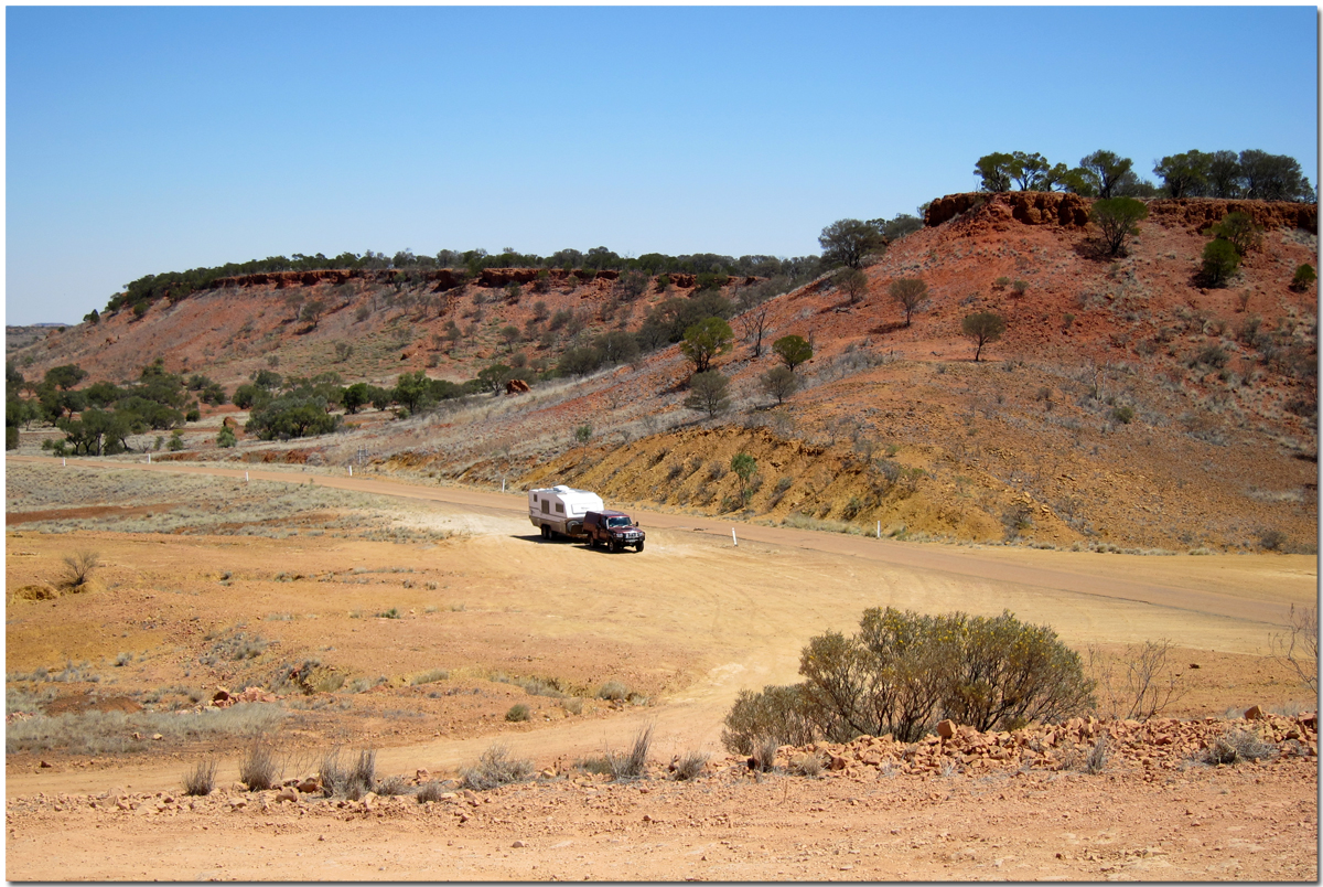
Today's drive is only 90 km. We are heading to camp at the Old Cork Waterhole just down from the station of the same name. The waterhole is several kilometres long and several hundred metres wide, and it is a permanent waterhole on the Diamantina River. The old homestead is built on a rise overlooking the water. Old Cork was first settled in the 1860s, when pastoralists were applying for land along the Diamantina River. The homestead was built between 1880 and 1885 with local sandstone and imported timber from south-east Queensland.
Today's drive is only 90 km. We are heading to camp at the Old Cork Waterhole just down from the station of the same name. The waterhole is several kilometres long and several hundred metres wide, and it is a permanent waterhole on the Diamantina River. The old homestead is built on a rise overlooking the water. Old Cork was first settled in the 1860s, when pastoralists were applying for land along the Diamantina River. The homestead was built between 1880 and 1885 with local sandstone and imported timber from south-east Queensland.


We thought we would have the place to ourselves, but just after 4pm, two camper trailers arrived, though they camped at a considerable distance from us.


Distance 90 km; total distance 6,186 km.
September 19:
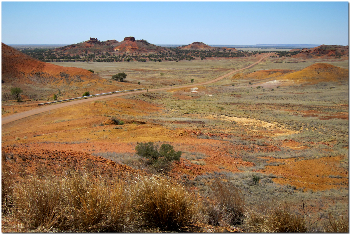
The drive south towards Diamantina National Park features some lovely scenery, especially the hills near the Mayne Hotel ruins.
September 19:
The drive south towards Diamantina National Park features some lovely scenery, especially the hills near the Mayne Hotel ruins.


We set up camp at Hunters Gorge campground. We sat in the shade of the van as strong wind gusts caused chaos with the dusty conditions. It was so bad that opening any part of the van would have let in even more dust. When the wind finally died down at 4.30pm, the inside temperature of the van was 41 degrees.


Distance: 148 km; Total distance: 6,334 km.
September 20: We set out at 7am to drive the 90 km Warracoota Circuit. The drive takes you past red sand hills, gibber plains, grasslands, lakes, and waterholes, as well as sites that were once used when it was a grazing property. The sites we enjoyed included Lake Constance, which now only fills when floodwater levels reach 4.5 metres.
September 20: We set out at 7am to drive the 90 km Warracoota Circuit. The drive takes you past red sand hills, gibber plains, grasslands, lakes, and waterholes, as well as sites that were once used when it was a grazing property. The sites we enjoyed included Lake Constance, which now only fills when floodwater levels reach 4.5 metres.


The Ruins, which contain several loose stone-wall structures believed to have been a settler outpost.


And some lovely sand dunes:

When we arrived back at our campsite at 11am, the wind was stronger than it had been yesterday, and the temperature was much worse. So, we decided to spend the remainder of the day in air-conditioned comfort. We hitched up the van and headed south.


September 21/22/23:
Today's drive to Windorah was once again on a single-lane bitumen road. We stopped to purchase several items from the one and only small shop in the town and filled our 4th water tank from a tap near the store that had a sign that said “feel free to use this filtered water from Coppers Creek” On the eastern side of Windorah is a solar farm that was commissioned in 2009. It can produce up to 360,000 kilowatt-hours of electricity each year. This amount of electricity would otherwise have required 100,000 litres of diesel to be used by the town's generators.
Today's drive to Windorah was once again on a single-lane bitumen road. We stopped to purchase several items from the one and only small shop in the town and filled our 4th water tank from a tap near the store that had a sign that said “feel free to use this filtered water from Coppers Creek” On the eastern side of Windorah is a solar farm that was commissioned in 2009. It can produce up to 360,000 kilowatt-hours of electricity each year. This amount of electricity would otherwise have required 100,000 litres of diesel to be used by the town's generators.

Coopers Creek was named by Charles Sturt in 1845 and said, " Before we finally left the neighbour where our hopes had been so often raised and depressed. I gave the name of Cooper's Creek to that fine watercourse we had so anxiously traced, as proof of my respect for Mr Cooper, the judge of South Australia. I would gladly have laid this creek down as a river, but as it had no current, I did not feel myself justified in doing so."


Distance 92 km, Total distance 6841 km
September 24/25/26/27:
Currently in Longreach having the ute serviced, catching up on shopping and washing.
Distance 318 km, Total distance 7159 km.
September 24/25/26/27:
Currently in Longreach having the ute serviced, catching up on shopping and washing.
Distance 318 km, Total distance 7159 km.
4 comments:
Hi Ros and Ross, we met you at Coopers Creek and talked about the BOG, KOG and SOG gathering. The gathering is on the Australia Day Weekend and will be at Six mile Country Retreat at Murphys Creek Queensland. http://sixmilecountry.com.au/
More BOGers needed...
Hopefully see you there.
Erich and Lesley
Lesley & Erich,
Looks like we should be able to make the gathering. Will see you there.
RnR
Another interesting story R&R, i enjoy the photo's as well. Your doing very well with the economy if the worst is 19lt per 100 ... that would be our average.
Thanks Mick,
We are never in a hurry to go anywhere and just dawdle along. The country in western Queensland is just amazing.
Post a Comment